Description
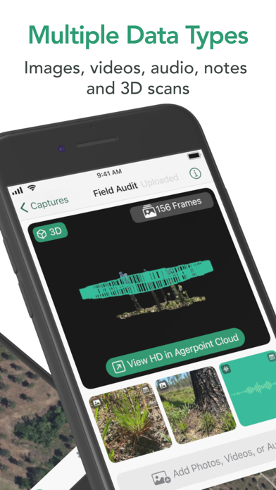
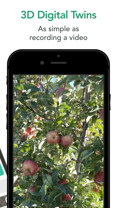
Simplify field data acquisition and analysis with Agerpoint Capture. Use your smartphone or tablet to capture 3D scans, take images, record audio samples, and document field notes to create digital twins of crops and forests.
Agriculture and nature professionals capture data with their mobile device by walking around a single plant or planted area of interest.
Agerpoint Capture uses camera, LiDAR, and GPS data to record images, depth and location. Live augmented reality feedback guides you towards a successful capture.
Inspect and interact with your 3D models and captures onboard your mobile device.
Upload captures to the Agerpoint Cloud platform for more detailed modeling and measurements, including plant health, inventory, fruit count and sizing, disease presence, species identification, and much more.
In Agerpoint Cloud, mobile captures can be fused with other data sources including satellites, drones, and IoT sensors, creating a comprehensive digital record of your field or forest.
Upload requires an Agerpoint account subscription and Wi-Fi or cellular connectivity.
Only use Agerpoint Capture in safe environments and exercise caution when capturing data.
Nouveautés (v1.5.2)
- Adds path guidance to custom 3D subject presets, letting you provide realtime guidance for the best 3D capture of your subjects in the field. It's never been easier to ensure your captures have the speed, angle, and stability needed to create a clear and actionable digital twin.
- Updates multi-step capture UI to improve in-field capture experience.
- Updates capture info UI to better reflect all information collected.
- Updates app icon and styles for the new Agerpoint brand.
- Other smaller bugfixes throughout the application.