Weather
MyRadar Weather Radar Pro
par Aviation Data Systems, Inc
£5.99
Prix actuel — pas de promo en cours
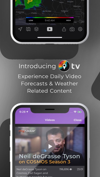
Captures d'écran


Description
Whether its rain, storms, tornadoes, earthquakes, wildfires or hurricanes, MyRadar will keep you informed. Thanks to everyone for making MyRadar so successful, with over 50 million downloads!
MyRadar is a fast, easy-to-use, weather application that displays animated weather radars around your current location, allowing you to quickly see what weather is coming your way. Our High Definition Doppler radar data is processed from raw NOAA weather radar data from the National Weather Service / NWS using our custom-designed, proprietary systems and software, offering the clearest, sharpest, most accurate and most up-to-date reflection of precipitation available... easily accessible at the tap of a finger on your mobile device.
Just start the app, and your location pops up with animated weather, allowing you to easily see if rain or snow is headed your way. Our high-res animated radar helps you see weather details even at the closest level!
What's great about MyRadar is that the map is easily zoomed and scrolled around with the flick of a finger, allowing you to quickly check the weather in other parts of the country, including Hawaii & Puerto Rico!
On top of the basic weather forecast, users can get a quick glance of temperatures around the country, as well as overlay a current satellite image of cloud cover. For you aviation buffs, there's a layer that provides Airmets & Sigmets, and even the ability to overlay the flight plan of a particular aircraft onto the map. You can also share interesting weather photos from your area, and see photos other users have contributed neatly displayed on the map.
Additional options include weather warnings and alerts, complete with push notifications, to warn you of severe weather in your area. Great for the start of thunderstorm and tornado season! There's also an optional hurricane tracker, providing excellent details and projections for the path of storms as the season looms near.
MyRadar currently shows weather for the United States (including Alaska, Hawaii, and Puerto Rico, when HD Radar is enabled).
Download MyRadar today and try it out!
--------
If you choose to purchase the Aviation Charts subscription, which is not required in order to use MyRadar, payment will be charged to your iTunes account, and your account will be charged for renewal within 24-hours prior to the end of the current period. Auto-renewal may be turned off at any time by going to your settings in the iTunes Store after purchase. The current subscription for the Aviation Charts starts at $24.95 USD per YEAR. Prices are in U.S. dollars, may vary in countries other than the U.S. and are subject to change without notice. No cancellation of the current subscription is allowed during the active subscription period. If you don’t choose to purchase the subscription for the Aviation Charts, you can simply continue using MyRadar for free.
For MyRadar’s Privacy Policy, visit: http://myradar.com/privacy_policy
For full terms of service visit: http://myradar.com/tos.pdf
Nouveautés (v7.121.2)
New in 7.121:
- Webhooks: Connect MyRadar alerts to your custom software or third-party solutions! With this feature, you can configure a webhook to receive alerts and other notifications for a chosen location. Requires a Premium Features subscription and a free MyRadar account.
- Live outdoor cameras: View live streams from various PTZ cameras around the U.S. Layers > Storm Chasers/Live Cameras.
- Per-Station: The nearest non-TDWR station to the center of your map location is listed at the top of the list of radar stations.
- CarPlay: "Storm Centers" allow you to see the movement of some tracked storms.
Fixes and improvements:
- Per-Station: Products that are temporarily unavailable for a radar station will show as disabled in the list.
- Tapping on a RouteCast route pulls up the UI to change or remove the route.
- Increased brightness of reflectivity products in Per-Station radar.
- Fixed a bug that caused the RouteCast UI to disappear when rotating to landscape.
- Fixed a bug where timestamp labels for exported images and videos from the map would be in UTC instead of the device's local time.
- Fixed a bug that caused the video gallery to flash blank temporarily when a video was selected.
- Fixed a bug where the photos welcome screen was presented twice during authentication.
Fixes in 7.121.2
- Fixed a bug where the distance tool would leave labels on the map after each use.