qtVlm is a navigation software for Sailing Boats. The application has a free version with basic features and a full version available through in-app purchase.
The free version of qtVlm is a full grib viewer displaying all types of gribs and providing many advanced grib functions. It supports basics charts and some simple instruments. It includes also an Anchor Alarm module, a viewer for shapefiles, for instance those coming from SHOM, and can be configured to receive boat position either from internal GPS or from an external NMEA source connected through tcp, udp or gpsd.
The full version adds many functions and features:
- Weather routing and route modules,
- A complete set of navigation Instruments,
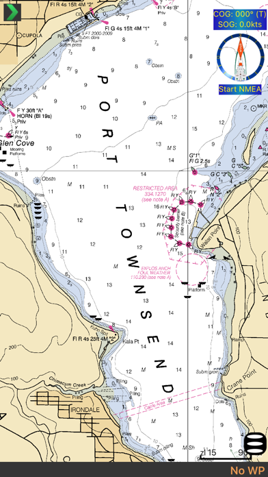
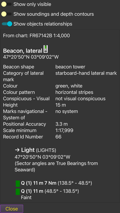
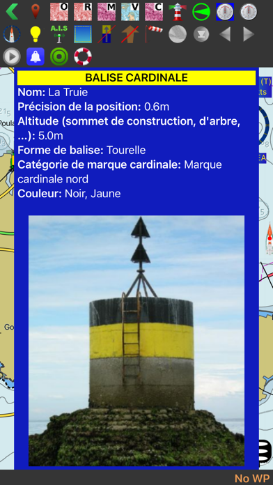
- Charts modules for Raster charts, Vector charts (S57, S63 and CM93) and mbtiles,
- Support for Harmonic files (tides and currents),
- Iridium GO! communication
- AIS,
- Start line mode,
- Access to Great Circle gribs,
qtVlm can also be used in Simulation Mode, which allows you to simulate a navigation through our server. This is the best way to learn using qtVlm.
Once activated the full version will be available on all your iOS devices.
What's new (v5.12.2500)
New Chart insert module, allowing to open another window for showing other charts or places. Add possibility to drop a POI on an object found by "Search in ENC charts"
Use grib model name in meteogram.
Add support for Portuguese (Brazilian) language. Refactor palette and style implementation (and day/dusk/night modes). Add an optional High-Contrast (CVD) mode
A fix in route's tooltip concerning waves, and a fix in route's optimization
Fix reversed engine in simulation mode